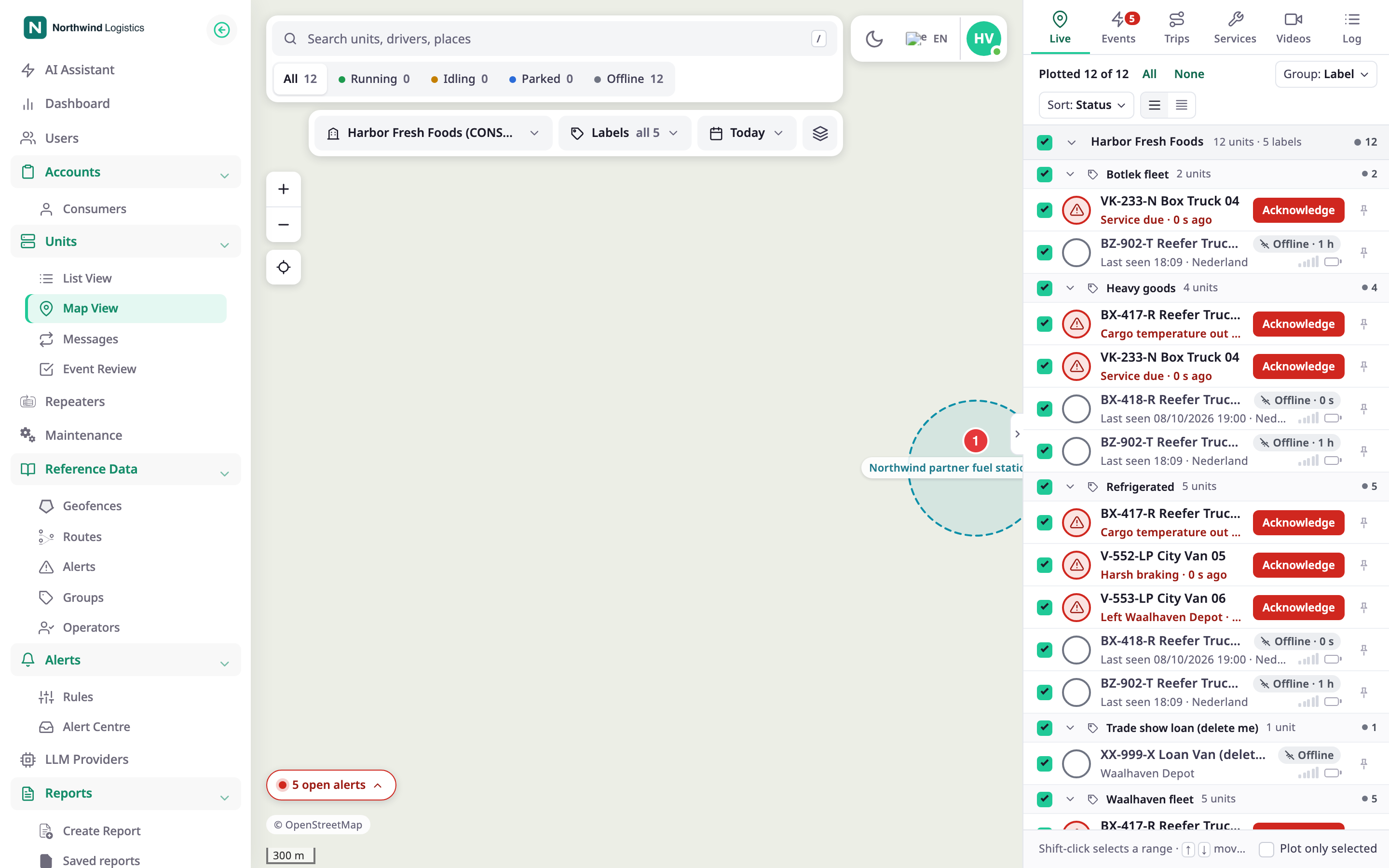
Three controls on the scope bar decide what the map shows: the account button, Labels and Layers. To reach them, in the side menu, select Units > Tracking. The scope bar sits at the top of the map.
¶ Account scope
The account button shows the account whose units you see. When more accounts are in scope, it shows +N after the name. Select it to open Account scope.
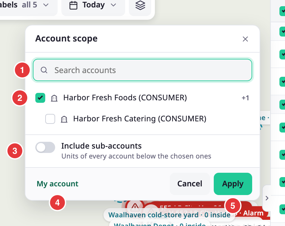
| Control | What it does |
|---|---|
| Search accounts, marked 1 | Filters the list of accounts by name. |
| Account, marked 2 | A checkbox for each account you can reach, indented under its parent. +N after a name is the number of accounts below it. |
| Include sub-accounts, marked 3 | Adds the units of every account below the ones you chose. |
| My account, marked 4 | Goes back to your own account. |
| Cancel | Closes the dialog and keeps the scope as it was. |
| Apply, marked 5 | Applies your choice. It stays off until you choose at least one account. |
The list of units, the status counts and the map follow the scope. A dealer account starts on its own account, which owns no units, so a dealer chooses a consumer account first.
¶ Labels
Labels shows how many labels filter the list, or "all" and the number of labels when none do. Select it to open the list.
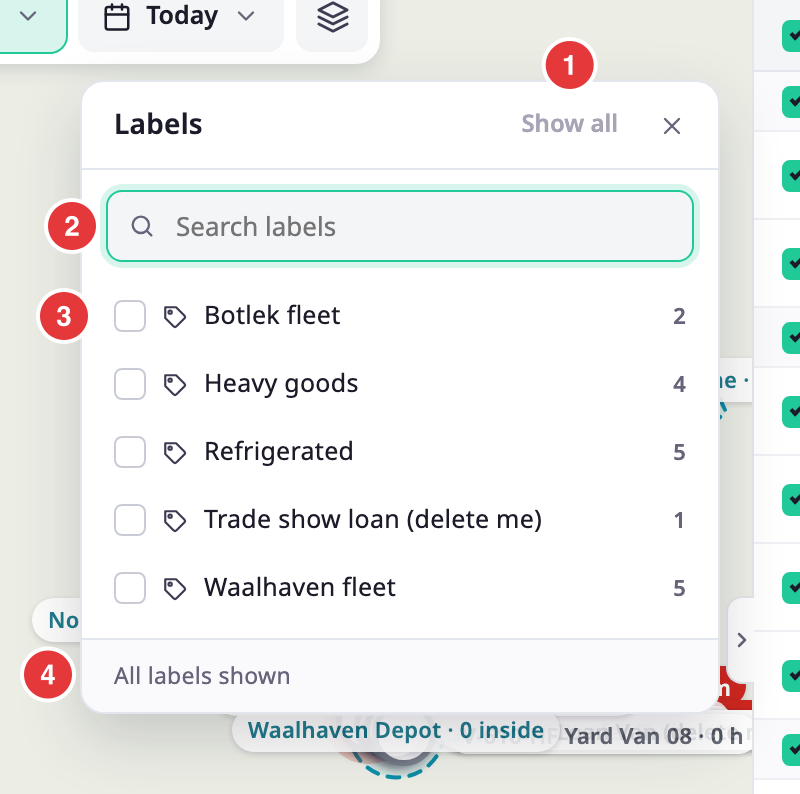
- Select a label to keep only units that carry it. You can choose several. A unit with any chosen label stays.
- The number next to a label is how many of the loaded units carry it.
- Show all, marked 1, clears the choice. The footer, marked 4, says how many labels you selected.
- Search labels, marked 2, filters the list.
Labels are the groups you manage under Groups. Without Read on Labels, the list comes from the units already loaded. Labels is not available on a phone.
¶ Layers
The Layers button, the last button on the scope bar, opens the Layers panel. It has three parts: Base map, Overlays and Map style.
¶ Base map
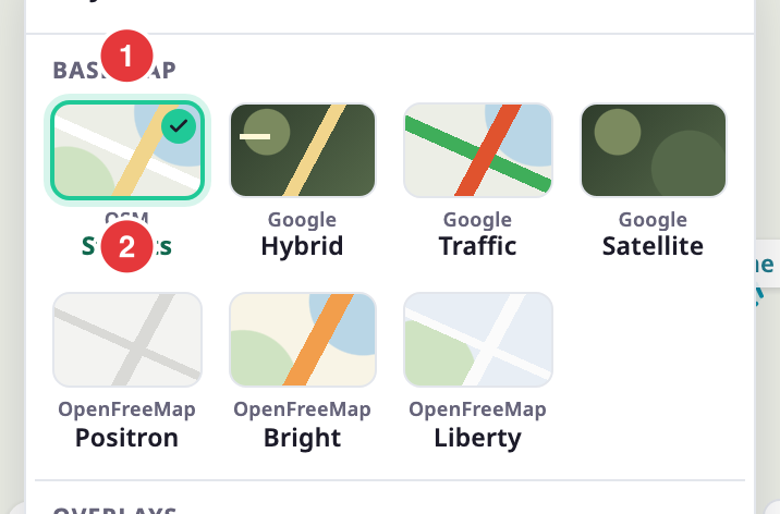
Choose one base map. Each tile shows the provider and the kind of map. The picture shows the choices.
| Base map | Hint in the panel |
|---|---|
| OpenStreetMap | free. This is the default, and it is always offered. |
| Google Hybrid | labels on satellite |
| Google Traffic | live congestion |
| Google Satellite | imagery only |
| OpenFreeMap Positron | light, muted |
| OpenFreeMap Bright | high contrast |
| OpenFreeMap Liberty | streets |
| Yandex Map | streets |
| Yandex Satellite | imagery only |
| Yandex Hybrid | labels on satellite |
| Azure Road | streets |
| Azure Aerial | imagery only |
| Azure Hybrid | labels on imagery |
You see only the base maps your account offers. The account settings choose them, and a Yandex map shows only when the account has a working Yandex key.
¶ Overlays
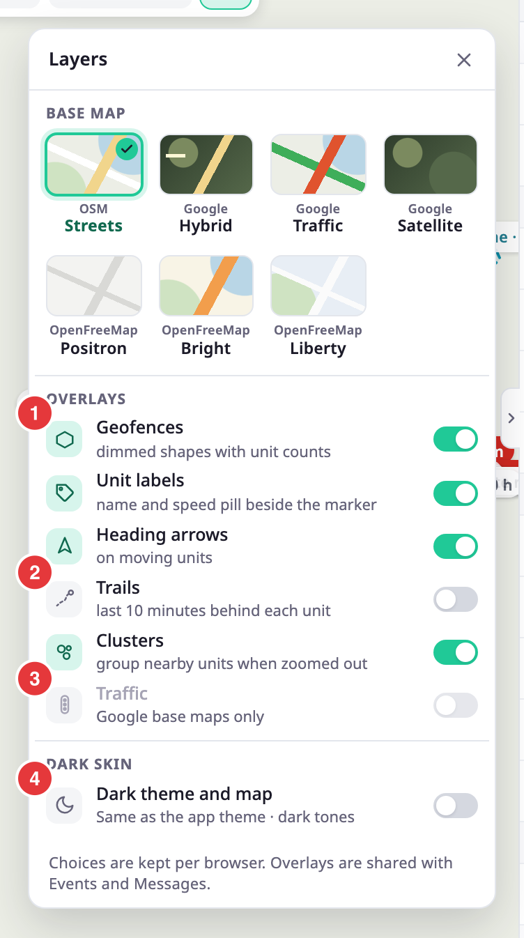
Overlays are switches on top of the base map.
| Overlay | What it does | Default |
|---|---|---|
| Geofences, marked 1 | Draws your geofences as read-only shapes, each with a chip such as "Waalhaven Depot · 7 inside". It shows only with Read on Geofences. | On |
| Unit labels | Shows the name and speed in a pill beside each marker. | On |
| Heading arrows | Shows an arrow on moving units. | On |
| Trails, marked 2 | Draws the last 10 minutes behind each unit. | Off |
| Clusters | Groups nearby units into a circle with a count when you zoom out. It applies only above 300 plotted units. | On |
| Traffic, marked 3 | Shows live congestion. It works on the Google, Yandex and Azure base maps. On Google Traffic it is already on. | Off |
| Live chat | Pops up new chat messages from drivers over the map. The unread badges update either way. It shows only when you can read unit chat. | Set by the account the first time; then your browser keeps your choice |
The geofences are the ones you manage under Reference Data > Geofences. A chip counts the units inside the shape now.
¶ Choose which geofences show
With Geofences on, a list of the account's geofences opens under the switch.
- Enter part of a name in Search geofences to find one.
- Tick geofences to show only those. With none ticked, the map shows them all.
- Select Show all to clear the ticks.
The geofences you tick also show on the Geofences and Messages maps, and as read-only reference shapes while you draw or edit a geofence.
¶ Map style
Map style decides whether the map is light or dark. It is separate from the app's light and dark theme.
| Choice | What the map does |
|---|---|
| Auto | Follows the app theme. This is the default. |
| Light | Stays light in either app theme. |
| Dark | Stays dark in either app theme. How it looks depends on the base map: a dark Positron style, dimmed imagery or dark tones. A Yandex map has no dark style. |
The Geofences and Messages maps follow the same Map style.
¶ What the app remembers
- Your browser remembers the base map, the overlays and Map style for your user. The panel footer says the choices stay per browser and that Events and Messages share the overlays. A colleague, or you in another browser, starts with the defaults.
- The Geofences and Messages maps start from the base map, the selected units and the geofences you chose here.
- The accounts and labels you chose are in the address of the page. Copy the address to share the view.
¶ Permissions
- Account scope and Labels need Read on Units.
- Geofences needs Read on Geofences.
- Live chat needs the chat feature on your installation and the read right on unit chat.